3D Scanning
3D Digitization as Part of Holistic Plant Design
For plant planning or as a service
No matter whether for new construction or conversion in existing buildings – an accurate measurement of the conditions is necessary even with the best digital preliminary planning. Conventional measurement methods offer only low precision and it is never possible to capture all dimensions in one appointment.
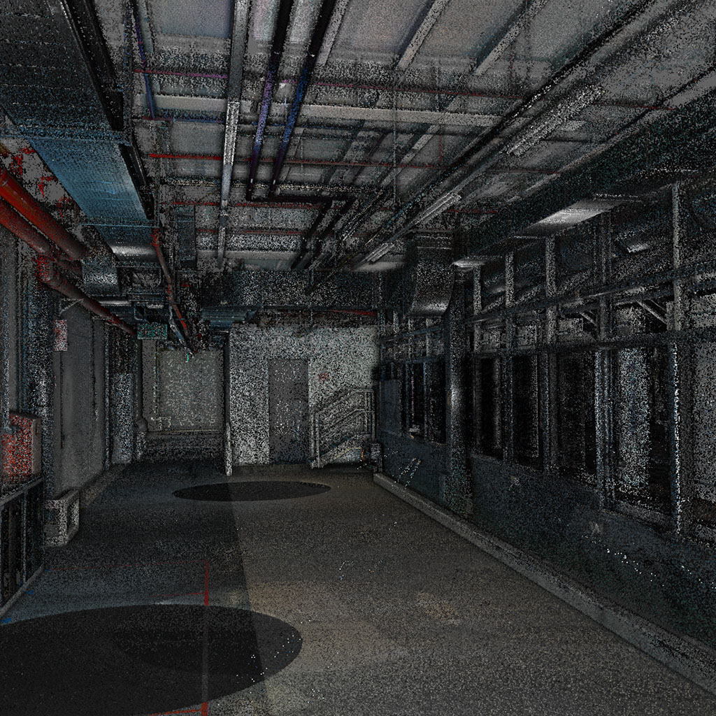
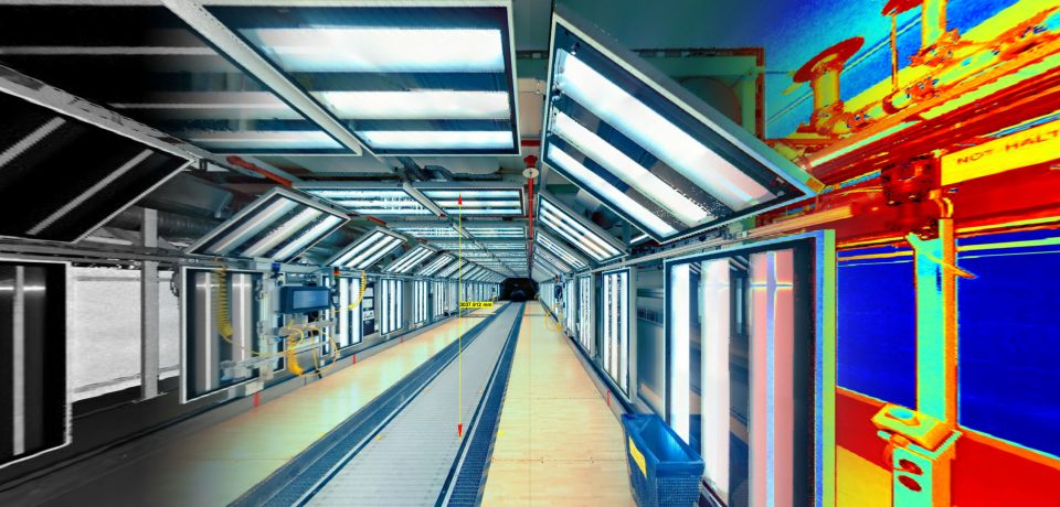
ASIS offers a highly precise 3D scanning procedure. In just one appointment, a digital image of the entire environment is created, which can be integrated and edited in all common 3D programs.
Advantages:
- Surveying tasks of all kinds in the sectors of mechanical and plant engineering, architecture, construction, agricultural engineering as well as in the municipal sector
- High-precision image of the entire environment
- All dimensions and details included
- One measurement date is sufficient
- Time and cost savings
- Compact technology, transportable in hand luggage
- Ideal for documentation of existing plants
- Acceleration of commissioning
Complete solutions from a single source
We are looking forward to your request.
* These fields are required.


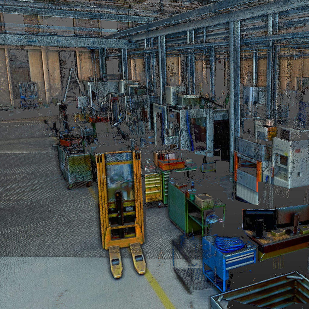
1. On-site Scanning.
The device is positioned on a tripod. After automatic leveling, the laser scanner records the surroundings at 500,000 points per second.
For a detailed measurement, the position is now changed several times and the process is started again. With each measurement, a 360-degree live photo is integrated into the dataset.
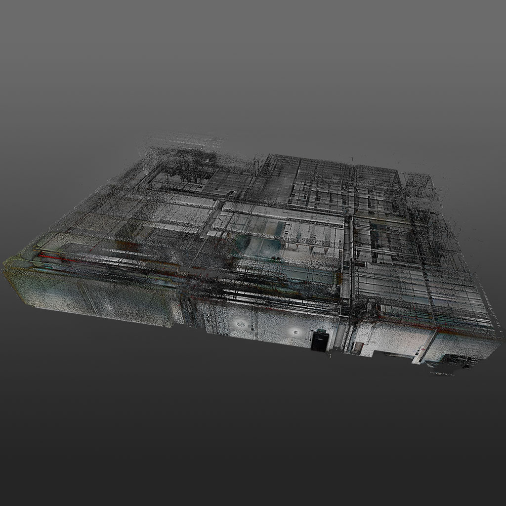
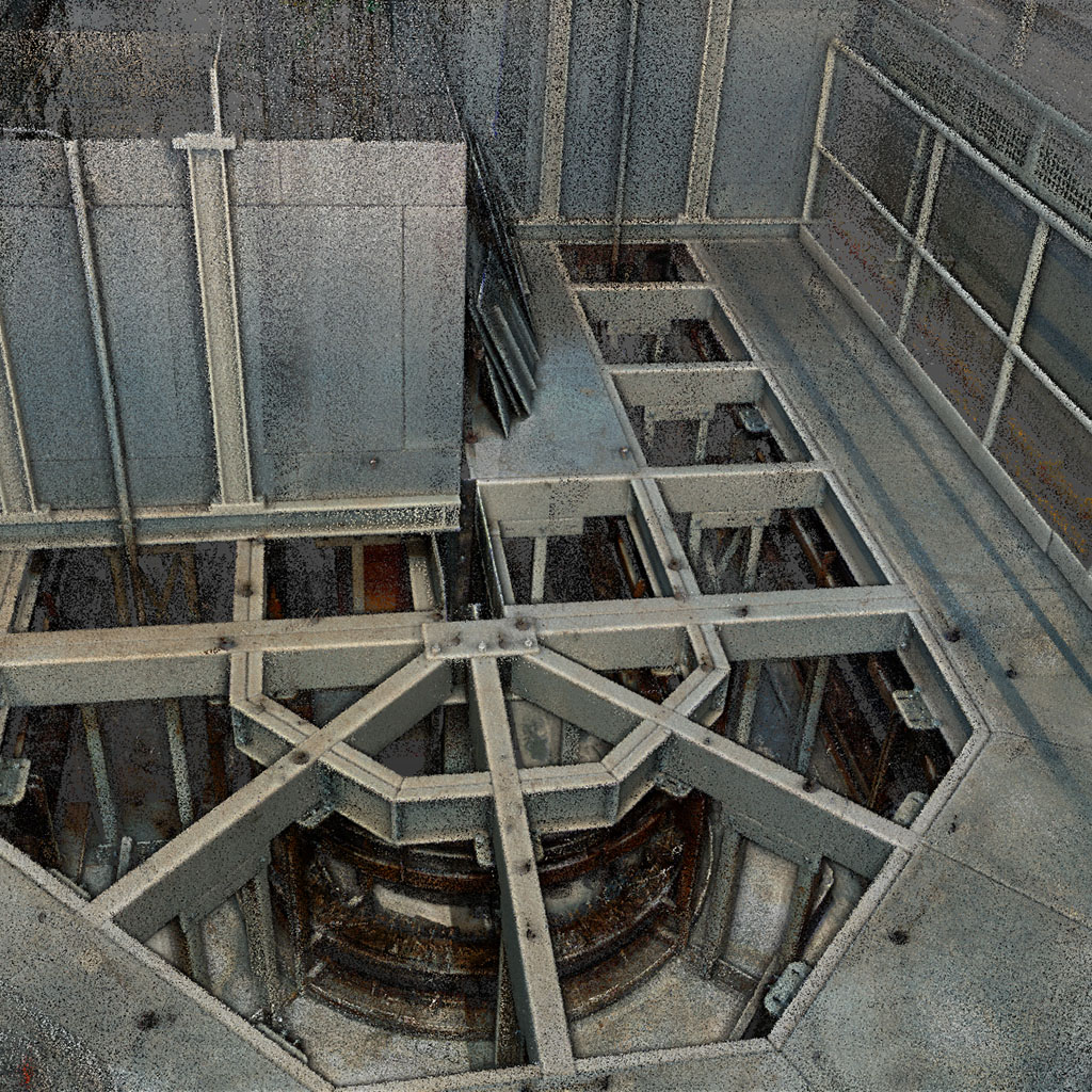
2. Total Map as a Cloud of Points
The unit remembers all previous positions and uses them to create a highly accurate digital image of the entire environment.
We provide our customers with an executable file. Here all positions are included and dimensions can be taken. This does not require a software license on the customer side.


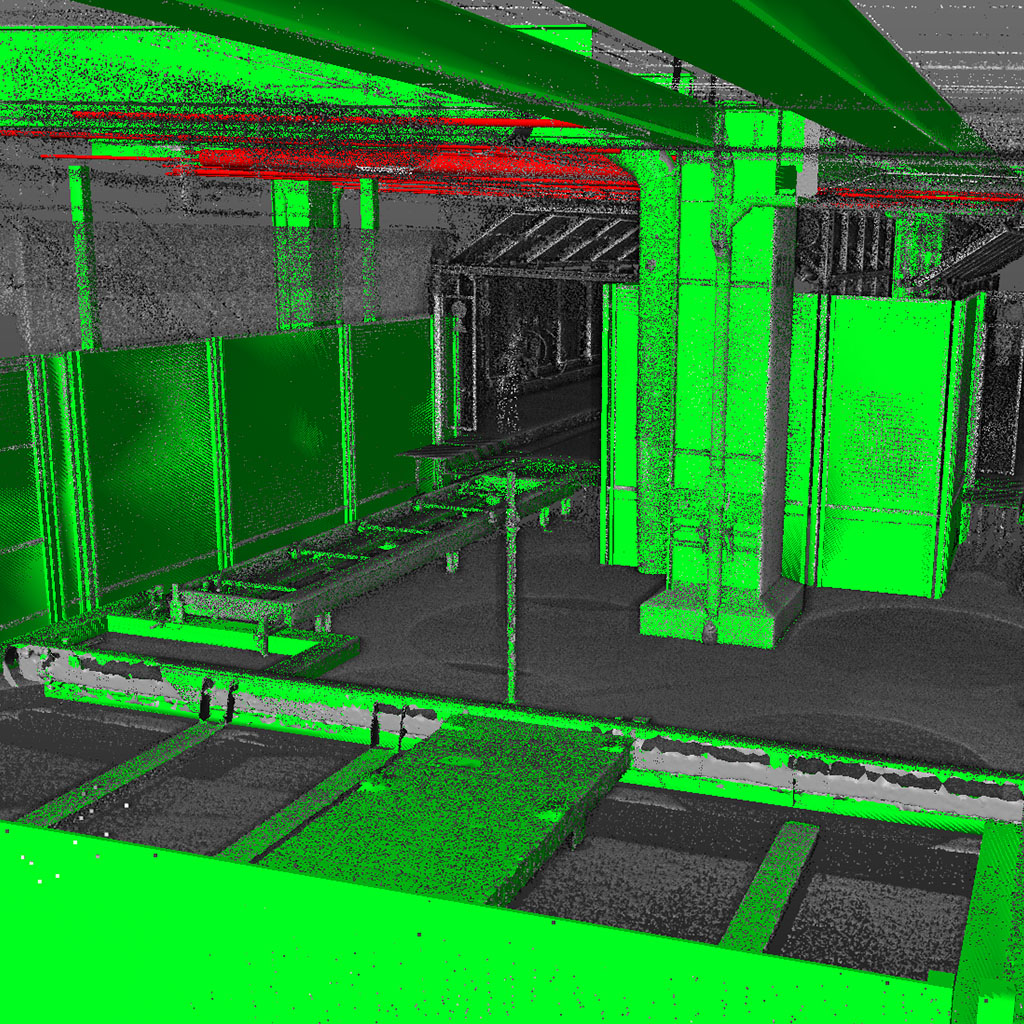
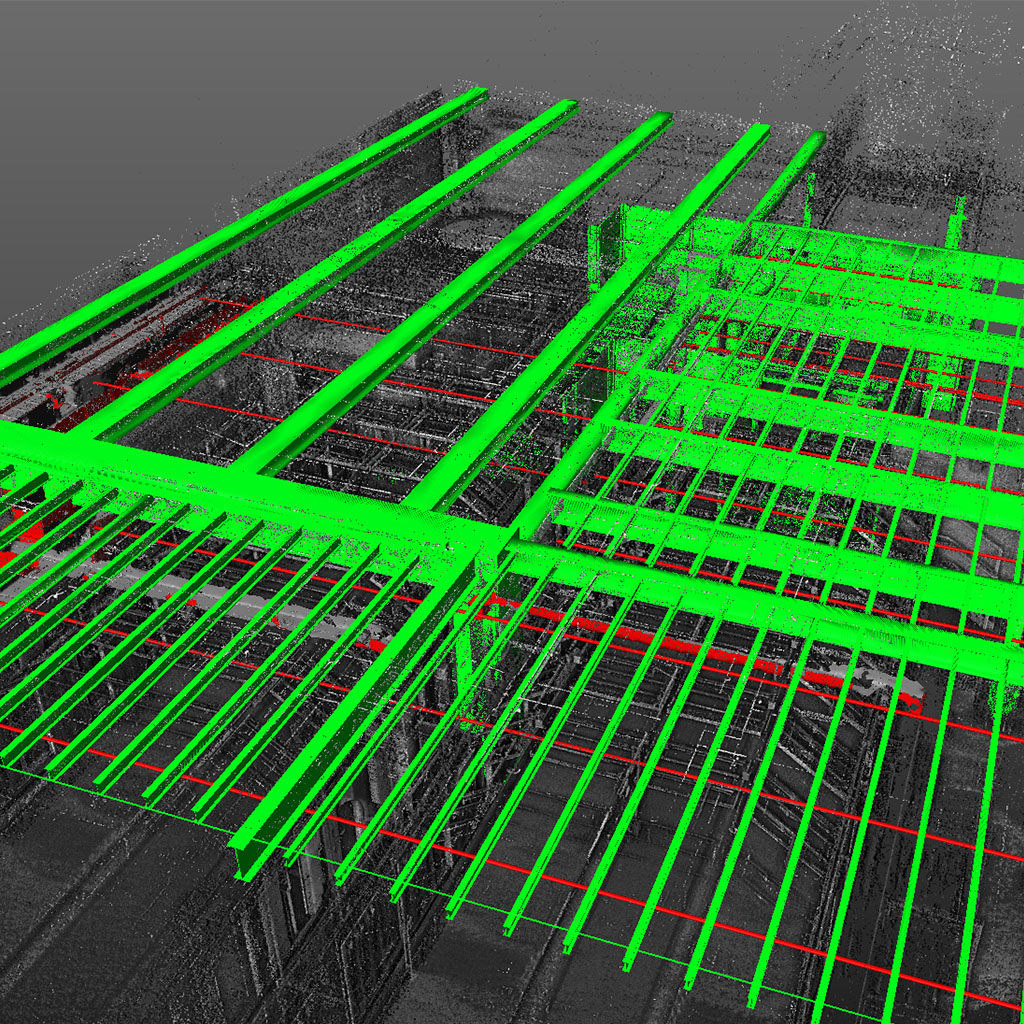
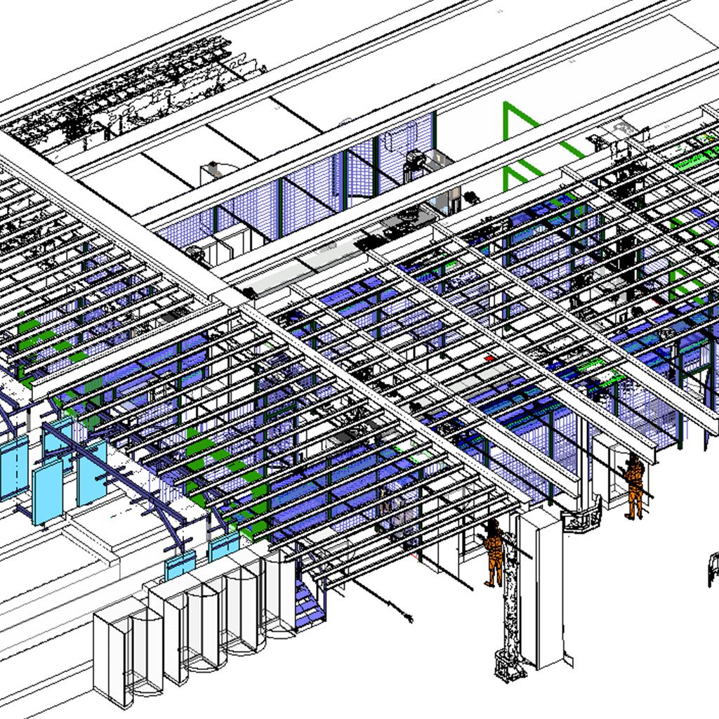
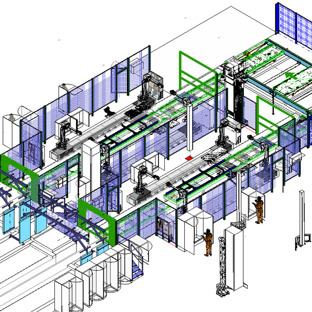
3. Modeling of Relevant Structures.
Afterwards, a powerful software converts the point cloud into surfaces and solids.
The point cloud becomes editable three-dimensional objects.
4. Integration of the Data into Plant Design
The 3D data obtained can now be integrated and further processed in all common 3D programs.
All details in the model are considered and 100% correct.